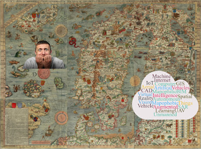
If you had chanced to look into maps made in medieval times, the dragons, multi-headed serpents and other strange fictional creatures marking the distant and unexplored lands on the edges of maps must have surely scared you. Cartographers of medieval times used the inscription HIC SVNT LEONES (“Here are Lions”) and notation of strange or mythical creatures to invoke the harm that sailors feared to encounter when entering previously uncharted territories. Mathematics has been a bitter pill for many as kids. Nevertheless, geography and maps too have been a phobia to many as well. From spatially locating continents, countries, states, cities on a map to getting the capitals right, it has been a nightmare for many experiencing symptoms from racing hearts, sweating, dizziness, disorientation and panic when looking at maps.
MapQuest founded in 1967 as a cartographic services division of R.R. Donnelley & Sons launched online maps, the web services version of present day in 1996. MapQuest is still one of the most widely used online mapping services. Google’s findings in 2004 that over 25% of its searches were of a geospatial character, including searches for maps and directions laid the foundation for its acquisition of Keyhole, the core technology behind Google Earth. Later in 2005, Google Maps was launched, which first started as a C++ program designed by two Danish brothers, Lars and Jens Eilstrup Rasmussen.
Where are we?
Thanks to web & mobile based global online map services such as Google Maps, MapQuest, Open Street Maps and Bing Maps to name a few, for having revolutionized the reach of maps. We live in interesting times, where maps are the order of the day. From daily commute to work, holiday planning to exotic places, shortest routing for emergency response, catastrophic natural disaster preparedness & relief, strategic planning to global warming, maps are used everywhere. There is a lot more awareness about importance of location intelligence and Geographical Information System (GIS). People are no more phobic to maps but philic. Maps, location intelligence and GIS are becoming part of our everyday lives sometimes even without us being aware!
The power of location intelligence is of more importance than ever for businesses of this age. Location intelligence is the main stay of several disruptive innovations of today and continues its key position in futuristic disruptive technologies such as Internet of Things (IoT), Artificial Intelligence (AI), Machine Learning (ML), Unmanned Aerial Vehicle (UAV), Augmented Reality (AR), Spatial Augmented Reality (SAR), Virtual Reality (VR), Autonomous Vehicles (AV), Computer Vision (CV) etc.
The Challenges
With mobile/connected devices becoming ubiquitous today, the amount of location data generated is enormous. Ever growing location intelligence based disruptive innovations and platforms together with disruptive technologies are proving to be the key differentiator to businesses to improve customer experience, drive revenue and increase operational efficiency. Disruptive technologies like IoT, AV, CV, UAVs etc. are delivering information that has never been possible before, creating entirely new avenues for geospatial data collection, while posing challenges for geospatial data storage, retrieval and analysis. Location-based analytics and platforms that can process and detect trends and provide intelligence are becoming more popular. This has resulted in greater adoption of cloud-based platforms for enterprise GIS deployment involving big data.
Gartner, Inc. had forecast that 8.4 billion connected things to be in use worldwide in 2017, 110 percent of the world population estimated at 7.6 billion as of April 2018, up 31 percent from 2016, and predicted to reach 20.4 billion by 2020.
Big data is all about the notorious five Vs: Volume, Variety, Velocity and Veracity. With disruptive technologies based location intelligence innovations and platforms growing day-by-day, the big data and cloud computing industry are faced with the challenge of geospatial big data capture, storage, analytics, visualization and reporting (dissemination). Besides the typical challenges posed by the five Vs of big data, geospatial industry continues to be trapped in the ever growing matrix of not just GIS data formats and data types but also of non-geospatial nature.
Every Cloud has a Silver Lining
Disruptive innovations and platforms that generate and or consume geospatial big data, quickly reach criticality, where there is so much of (big) data that they are either unable to handle or do not know what to do with them. In this context ETL (Extract-Transform-Load) platforms and specifically Spatial ETL platforms have been the silver lining to the dark data format and data type clouds shrouding the geospatial (big) data industry. Incompatible systems are a thing of the past with Spatial ETL platforms, providing native support for location data, including the complexity of GIS, Computer Aided Drafting (CAD), Building Information Model (BIM) and latest big data eco-systems such as Hadoop. Spatial ETL platforms such as Feature Manipulation Engine (FME) from Safe Software provides the much needed geospatial (big) data conversion-transformation-share-integration along with geospatial analytical capabilities. Such Spatial ETL platforms are already available on the cloud such as Amazon AWS.
History of Big Data traces its first explosion to 1940s; the earliest documented use of the term “information explosion”, nevertheless geospatial data has always been Big Data. Despite challenges posed by Big (Geospatial) Data, it has the potential to improve operations and make quicker and intelligent decisions. Big (Geospatial) Data when converted, transformed, shared and or integrated appropriately using cloud based Spatial ETL platforms, can help organisations gain useful insight to increase revenues, better manage their assets and improve operations geospatially, in a BIG way!
This article was originally written by this author for Insights Success Magazine October 2018


